France Bordering Countries: Andorra, Belgium, Germany, Italy, Luxembourg, Monaco, Spain, Switzerland
Regional Maps: Map of Europe, World Map
Political Map

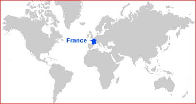
Map Location
Important city of France:
Aix, Ajaccio, Amiens, Angers, Avignon, Basel, Bastia, Bayeux, Bayonne, Besancon, Bonifacio, Bordeaux, Bourges, Brest, Caen, Calais, Cannes, Chalons-en-Champagne, Chambery, Cherbourg, Clermont Ferrand, Dax, Dijon, Dunkerque, Grenoble, La Rochelle, Le Havre, Le Mans, Lille, Limoges, Lorient, Lourdes, Lyon, Marseille, Metz, Montpellier, Mulhouse, Nancy, Nantes, Nice, Nimes, Orleans, Paris, Pau, Perpignan, Poitiers, Port Bou, Reims, Rennes, Rouen, Saint-Nazaire, Strasbourg, Toulon, Toulouse, Tours, Troyes and Valenciennes.